Hampta Pass sits in the Pir Panjal range of Himachal Pradesh, between the Kullu Valley and Lahaul. Follow the geography of the crossing, from the forest road above Manali to the Rani River valley, the pass saddle and the stark Chandra Valley.
Manali
Assembly point
Jobra
Trail starts
Hampta Pass
High crossing
Chatru
Road head
Quick answer
The Hampta Pass route runs Manali → Jobra → Chika → Balu ka Ghera → Hampta Pass (≈14,100 ft) → Shea Goru → Chatru, then returns to Manali by road through the Atal Tunnel. It is a crossing, not a loop on foot: you walk from the Kullu valley into Lahaul and drive back.
01
Where Hampta Pass is
Hampta Pass lies in the Kullu district of Himachal Pradesh, in the Pir Panjal range of the western Himalaya, close to the border with the Lahaul and Spiti district. It connects the Kullu Valley on the Manali side with the Chandra Valley in Lahaul.
02
Manali to Jobra
The journey begins with a steep road climb from Manali toward Jobra. The exact vehicle drop can vary with road condition and local access.
03
Rani River valley
From Jobra, the trail follows forest and meadow beside the Rani River through Chika and toward Balu ka Ghera. The valley gradually opens as altitude increases. The day-by-day walking distances show how long each stretch takes.
04
The pass crossing
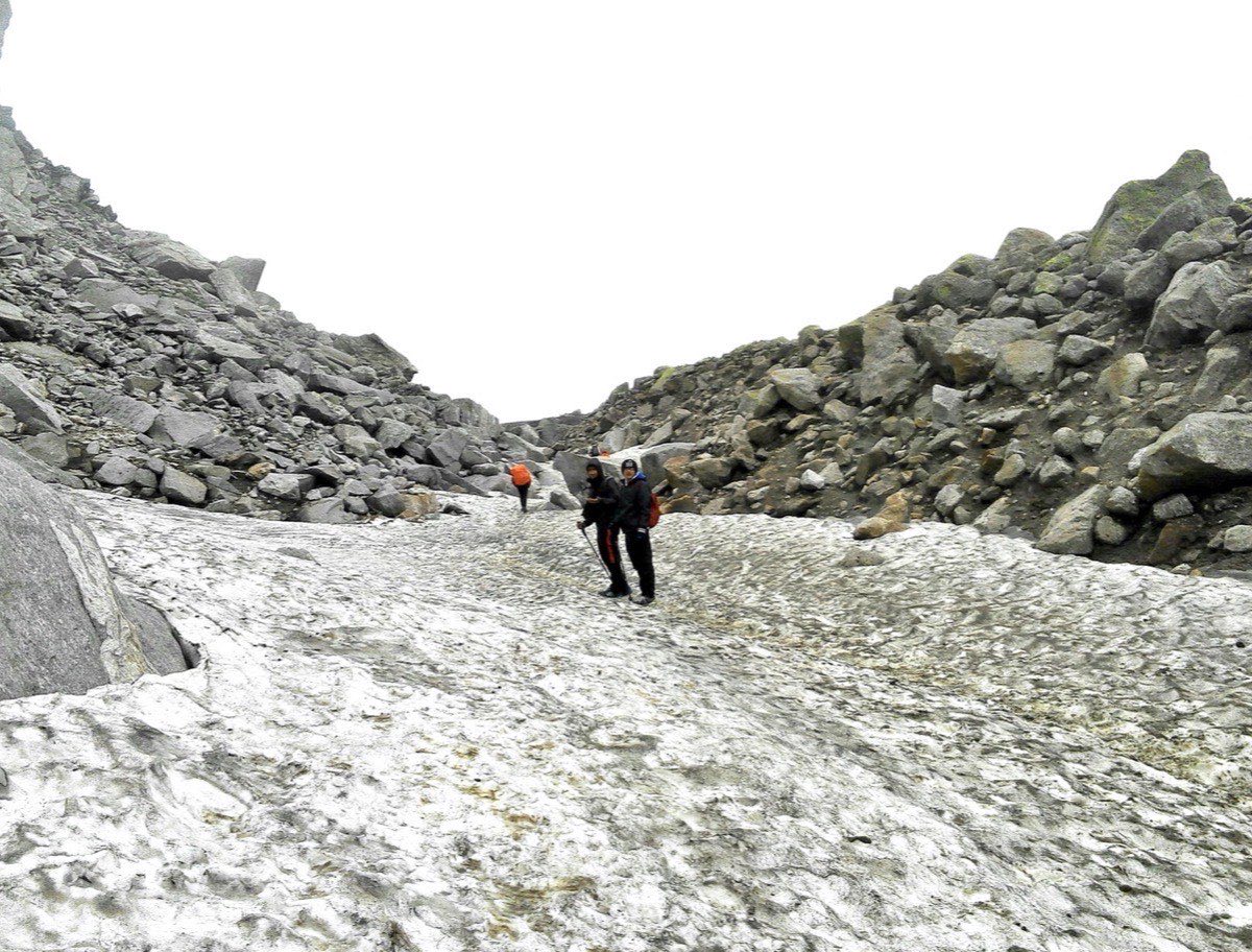
Beyond Balu ka Ghera, the route climbs over moraine, scree and seasonal snow to the pass saddle. Views open toward Indrasan and Deo Tibba before the route drops sharply into Lahaul. Read how difficult the pass day is before you commit.
05
Shea Goru to Chatru
The descent follows a colder, rockier valley to Shea Goru and then toward the Chandra River corridor at Chatru. Road travel completes the loop to Manali.
06
Route at a glance
Manali → Jobra → Chika → Balu ka Ghera → Hampta Pass → Shea Goru → Chatru → Atal Tunnel → Manali. Chandratal is a road extension, not part of the trekking trail.
07
What the trail surface is like
Expect pine and maple forest and wooden log bridges near Jobra, soft meadow and stream braids through Chika, boulder and moraine toward Balu ka Ghera, snow or loose rock at the saddle, and dry glacial rubble with icy stream crossings on the Lahaul descent.
08
A map, honestly
This page does not yet carry a downloadable GPX track or an embedded interactive map. Building one properly needs a verified track from an actual departure, and we would rather wait for a real one than publish an approximate line over high-consequence terrain. Until then, the waypoint table above and the route description are the most reliable written map we can offer, and your operator's pre-departure briefing will include their own stage map. A general OSM-based hiking layer around Hampta Pass and Chika can show the broad valley and pass location as background reading, but it should support a guide, not replace one.
09
Some operators use different camp names
A few operators and trip reports refer to the day-two stream crossing and camp area as Jwara rather than Chika. Both names describe roughly the same stretch of the Rani River valley; if you see Jwara mentioned elsewhere, it is the same stage, not a different route.
10
Navigation and markers
The valley is straightforward to follow in clear weather, but the final approach and the Lahaul-side descent have no reliable signage and become confusing in cloud or fresh snow. GPS tracks help, though they do not indicate whether a snow bridge or stream crossing is safe on the day.
11
Where Chandratal fits
Chandratal is roughly 70 km of rough road from Chatru toward Batal and Kunzum La. It is never walked from the pass. Treat it as an optional road add-on with its own access risk.
12
Reverse-direction treks
A few teams walk from Chatru toward Manali. This gains altitude faster with less acclimatisation and is generally considered the harder direction, which is why almost all commercial departures of the Hampta Pass Trek run Manali to Chatru.
Route waypoints
Route waypoints
Waypoint
Altitude
Terrain
Manali
≈6,700 ft
Town, road head
Jobra
≈9,800 ft
Forest road end, trail start
Chika
≈10,100 ft
Riverside meadow camp
Balu ka Ghera
≈11,900 ft
Glacial valley floor
Hampta Pass
≈14,100 ft
Narrow saddle, snow or scree
Shea Goru
≈12,900 ft
Cold, barren Lahaul valley
Chatru
≈11,000 ft
Chandra river road head
Common questions
Asked before booking.
Is there a downloadable map or GPX file for Hampta Pass?
Not yet on this site. We would rather publish a verified track from a real departure than an approximate line over terrain where a wrong turn matters. The waypoint table on this page and your operator's pre-departure briefing are the most reliable references in the meantime.
Why do some guides call the first camp Jwara and others Chika?
They are naming the same stretch of the Rani River valley on day two differently. Jwara and Chika are not separate route options.
Where exactly is Hampta Pass located?
In the Pir Panjal range of Himachal Pradesh's Kullu district, on the watershed between the Kullu Valley and the Chandra Valley in Lahaul and Spiti district. The nearest town and trek base is Manali.
Can the route change during the trek?
Yes. Campsites and crossing points shift with snow, water level and local instructions.
How far is the Manali to Jobra drive?
Roughly 16 km of steep switchbacks, usually about an hour depending on road condition and traffic. See how to reach Hampta Pass for the wider journey.
Is the return always through the Atal Tunnel?
Normally yes, which makes the return far quicker than the old Rohtang route. The tunnel itself is toll-free and open year-round, but the road beyond it into Lahaul can still close after heavy winter snow, which occasionally forces a longer alternative outside the trekking season.
Trek routes, weather, road access, campsites and Chandratal accessibility can change due to weather, trail conditions, local restrictions and operational decisions. Confirm current conditions and itinerary details before departure.